


VTD-Central precinct, McPherson County, South Dakota
About
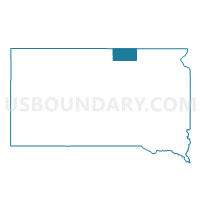
Outline

Summary
| Unique Area Identifier | 667527 |
| Name | VTD-Central precinct |
| County | McPherson County |
| State | South Dakota |
| Area (square miles) | 198.87 |
| Land Area (square miles) | 193.63 |
| Water Area (square miles) | 5.24 |
| % of Land Area | 97.36 |
| % of Water Area | 2.64 |
| Latitude of the Internal Point | 45.75114790 |
| Longtitude of the Internal Point | -99.33164740 |
Maps


Graphs
Select a template below for downloading or customizing gragh for VTD-Central precinct, McPherson County, South Dakota


Neighbors
Neighoring Voting District (by Name) Neighboring Voting District on the Map
- VTD-101 precinct, McPherson County, SD
- VTD-Eureka ward 2, McPherson County, SD
- VTD-Eureka ward 3, McPherson County, SD
- VTD-Northeast Leola, McPherson County, SD
- VTD-Northwest precinct, McPherson County, SD
- VTD-Southeast Leola, McPherson County, SD
- VTD-Southwest precinct, McPherson County, SD
Top 10 Neighboring County Subdivision (by Population) Neighboring County Subdivision on the Map
- Eureka city, McPherson County, SD (868)
- Central McPherson UT, McPherson County, SD (561)
- West McPherson UT, McPherson County, SD (271)
- Hoffman township, McPherson County, SD (25)
Top 10 Neighboring Place (by Population) Neighboring Place on the Map
Top 10 Neighboring Unified School District (by Population) Neighboring Unified School District on the Map
- Eureka School District 44-1, SD (1,305)
- Leola School District 44-2, SD (1,214)
- Edmunds Central School District 22-5, SD (1,021)